A representation of a surface in a GIS created through digital data. It is made up of irregularly distributed nodes and lines with three-dimensional coordinates (x, y, and z). See Lee (1991) Int. J. Info. Systems 5, 3, 267 for methods of building TIN models from grid digital elevation models.
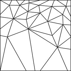
Triangular irregular network
Source: http://www.ncgia.ucsb.edu/cctp/units/unit06/tin.gif
- miscibility
- miscible
- MISD processor
- misery index
- mise-à-la-masse method
- misfit stream
- mismatch
- mismatch repair
- mispickel
- missense mutation
- missile
- missing market
- missing mass
- missing observations
- missing values
- mission
- mission control centre
- mission control team
- Mission Demonstration Test Satellite
- Mission Design Section
- mission elapsed time
- mission operations and data analysis
- mission specialist
- mission station
- mission status report